Just over a year ago, we posted news of a project, Love for Lothersdale Beck, which was shaping up in the home village of our Research & Conservation Officer, Jonny Grey.
The beck in Lothersdale has suffered more than a fair share of abuse over the years despite it being tucked away in a quiet little Yorkshire valley. It would have taken a considerable loading of fine sediment from the quarry at the top end of the system back in the day. It was shackled and harnessed for waterpower at the mill via an online pond to provide an offtake for the largest indoor waterwheel in Europe! Much of the native tree cover around Woodhead and Oakcliffe (clues in the names?) was felled and used for smelting. Slag and other waste was dumped through a chute directly into the culverted stream. Downstream of the village, the channel was straightened to accommodate a track on one bank and a village tip on the other which subsequently became a football pitch and is currently a field of pasture. To this day, the outdated sewer system which only services ~25% of the village frequently blows the manhole covers and unmentionables flow directly to the beck. Safe to say it could do with some TLC, tributary loving care, WTT-style.
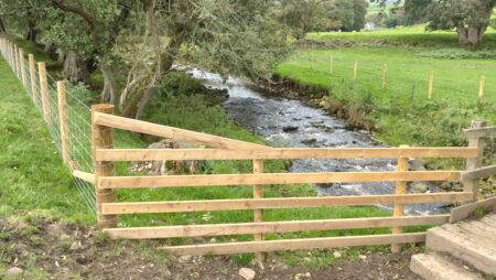
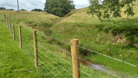
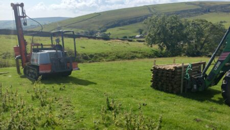
I laid out the project aims in the earlier news item. The fencing has been completed so ~3km of beck and tiny capillary tributary network have been protected from diffuse agricultural sediment and nutrient pollution. A few kilograms of local provenance wildflower seed were scattered in specific locations to kickstart a return to a more diverse flora from the formerly sheep grazed monoculture.
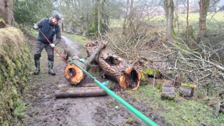
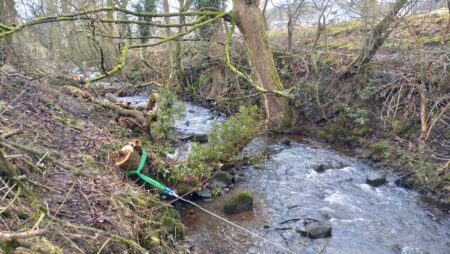
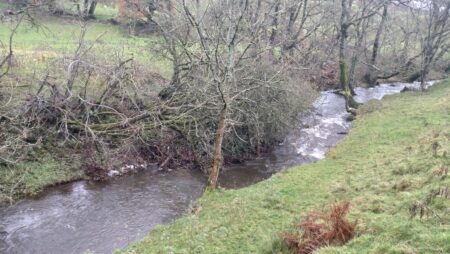
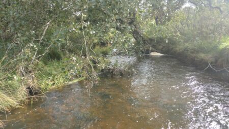
Lots of dead ash and a few bits of alder and sycamore have been laid or felled into the channel, and tethered where necessary. These have trapped finer vegetative debris and are now forcing physically diverse flow paths which help to retain and sort smaller substrate like gravel suitable for trout spawning. A few hundred tree whips are to be planted this winter, mostly on the smaller tributary network rather than on the beck where natural regeneration will have a chance now the main stressor, livestock, has been removed.
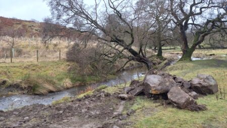
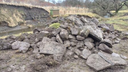
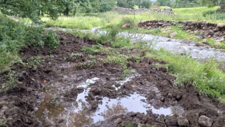
Connectivity was a key component of the project, both lateral with the floodplain, and longitudinal where the channel was fragmented by a perched and dangerously undermined ford. The ideal would have been full removal of the ford and replacement with a clearspan structure. However, to design and construct something capable of carrying farm traffic and without undermining footbridges and bank stability upstream was deemed too expensive relative to the environmental gain. Hence, a dispersed rock ramp was decided upon as a second-tier option, using material won locally. The majority came from the lateral connection work, removing piles of dredged boulder and cobble during the straightening era, and reprofiling of embankments studded with large boulders and concrete spoil! A trailer load of boulders to help key in the ‘ramp’ was donated by the owner of the quarry upstream (now Raygill Fishery, so he appreciates the work to improve the local trout population more than most).
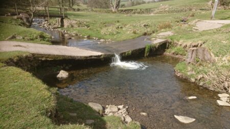
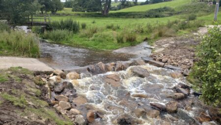
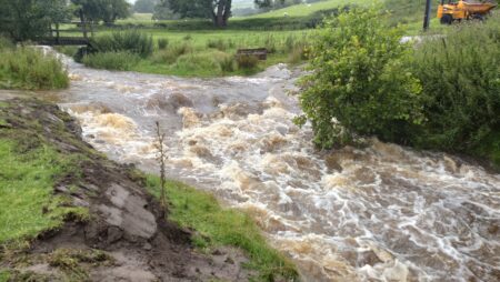
Prep work and construction only took a couple of days…..just as the start of our wet, wet, wet summer hit. Within 2 hours of completion, a summer flash flood put just as much water over it as an average winter spate. Typical, but a good test of our work. Nothing appeared to move. As you can see in the images above, under low flows prior to the works, a thin flume of water cascaded to the pool below. The rock ramp was designed to ‘drown out’ the ford ensuring sufficient depth at all times for fish passage and giving multiple pathways for ascending.
With more water ‘over the ford’ since, as it were, I decided to put a few more large boulders towards the tail of the ramp and dispersed further down the channel to stabilise it even more and to increase the hydraulic roughness. Adaptive management.…
So… was it the ‘how’ and did the fish cross the road (ford)?
Prior to securing the funding, I’d been using standardised annual electrofishing to monitor the fish community and specifically the trout population (of course), since 2017. The beck was one of several ‘controls’ against which I could compare other waterbodies where I had made interventions to improve habitat. From these data, it was clear that brown trout and bullhead managed to sustain populations upstream of the ford, but stone loach and brook lamprey were never recorded above, only below, and the loach there in great numbers.
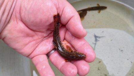
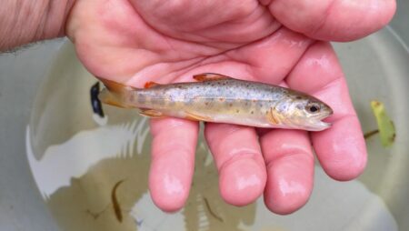
Three months after the rock-ramp was completed, the annual survey was due. To my delight, we encountered a handful of mature stone loach in the first reach upstream of the ford for the first time in seven years of surveys which suggested that we have definitely improved fish passage.
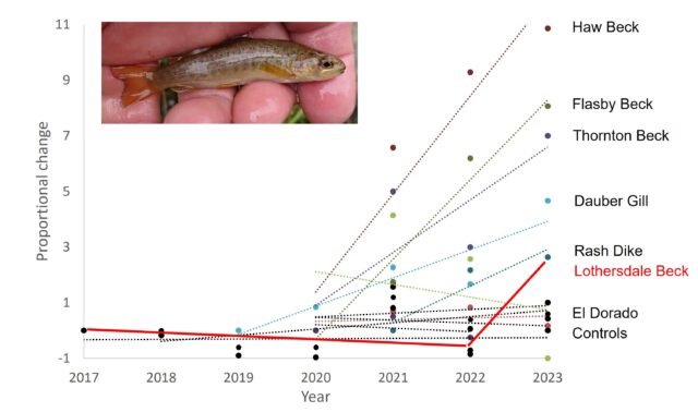
It was also particularly gratifying to see that numbers of young-of-year trout were up markedly as well – less likely directly associated with fish passage per se but more a reflection of the improvement in spawning and fry habitat. In the figure below, it is clear to see that the YOY trout numbers in Lothersdale Beck effectively flatlined from 2017 to 2022 prior to any works, but were almost 3x higher after improvements. Early days but I’m hopeful, given the trajectory of the TRoUT project sites (also in the figure) that numbers will be even better in 2024.
Love for Lothersdale Beck was primarily funded by a Biodiversity Enhancement Programme award to WTT from Yorkshire Water, with support from the Upper Aire Project and the West Yorkshire Branch of Salmon & Trout Conservation. It could not have progressed without the vision and support of the two landowners, the tenant farmer, and without a host of volunteer help from village residents (Wild About Lothersdale).
