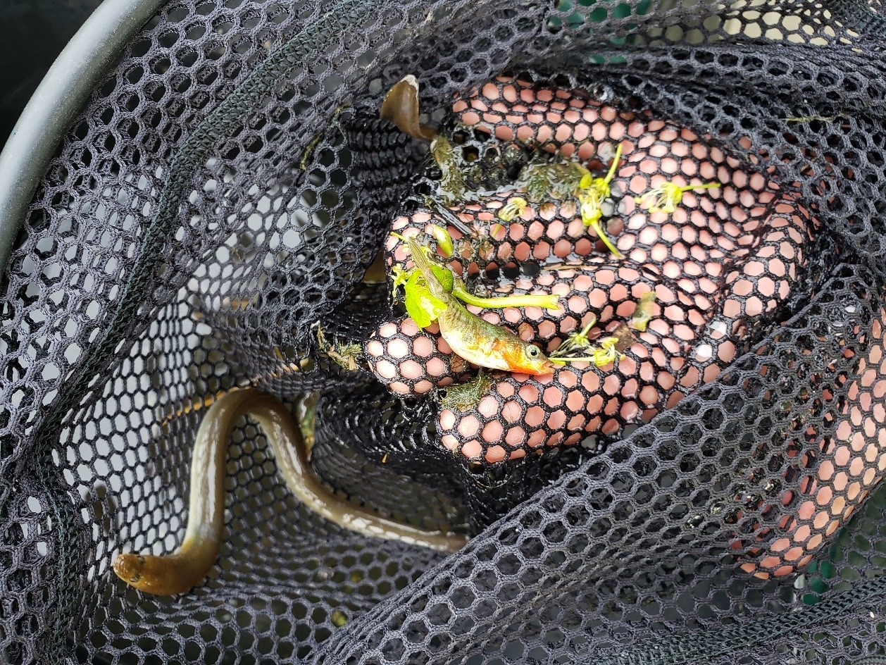
How did the fish cross the road?
In 2019, I had the pleasure of facilitating a project for Jessie Moravek, a former Fullbright Scholar studying for her MSc in Biodiversity & Conservation at Lancaster University. She’s now a PhD candidate at University of California, Berkeley, continuing to work on the plight of fishes in fragmented ecosystems.
It’s pretty clear that roads can be hard for wildlife to cross: lights, noise, and fast-moving vehicles pose challenges to deer, foxes, badgers, and other animals that might want to stroll to the other side.
But what about fish? Roads which cross small rivers and streams often create barriers that are almost impossible for fish to swim through. The water flowing through a culvert beneath a road can be very fast and shallow, purposefully engineered that way to reduce the chances of blockage. Bigger fish or at least the larger individuals and weaker swimmers, like European eel or lamprey species, often cannot swim through this fast and shallow water, so they cannot use the remainder of the river ecosystem on the other side of the culvert.
Woodplumpton Brook is an example of a stream with a problematic culvert. In the early 20thcentury, Woodplumpton Brook was important habitat for brown trout in the Wyre River catchment. But with the encroachment of agriculture, road construction, and an ill-planned culvert, by the early 2000s the Woodplumpton Brook ecosystem had greatly degraded. Trout were no longer recorded in the stream.
In 2016, a simple solution to the culvert in question on Woodplumpton Brook was devised. Tom Myerscough (Project Officer at Wyre River Trust), in collaboration Jon Grey at WTT, added a series of paired and offset baffles, bolted on threaded rod which was chem-fixed into the concrete inside the culvert. The baffles created a more sinuous flow path and slowed the velocity of water, offering resting places for fish in the slack water. They also increased water depth, thereby allowing larger fish to finally pass through the culvert.
The restoration effort at Woodplumpton Brook is subject to (ongoing) monitoring: Wyre Rivers Trust, WTT and Masters students from Queen Mary University of London and Lancaster University have all contributed to collect fish community data for four years. The dataset begins in 2016, just before the baffles were installed, and continues every year until spring 2019. A four-year data-set like this provides a valuable opportunity to evaluate how effective the culvert restoration has been to date.
Each year, fish communities in Woodplumpton were documented by electrofishing 50m stretches above and below the culvert. Each 50m stretch was sectioned off by nets and sampled three times (3‑pass depletion). Each fish was identified and measured for length.
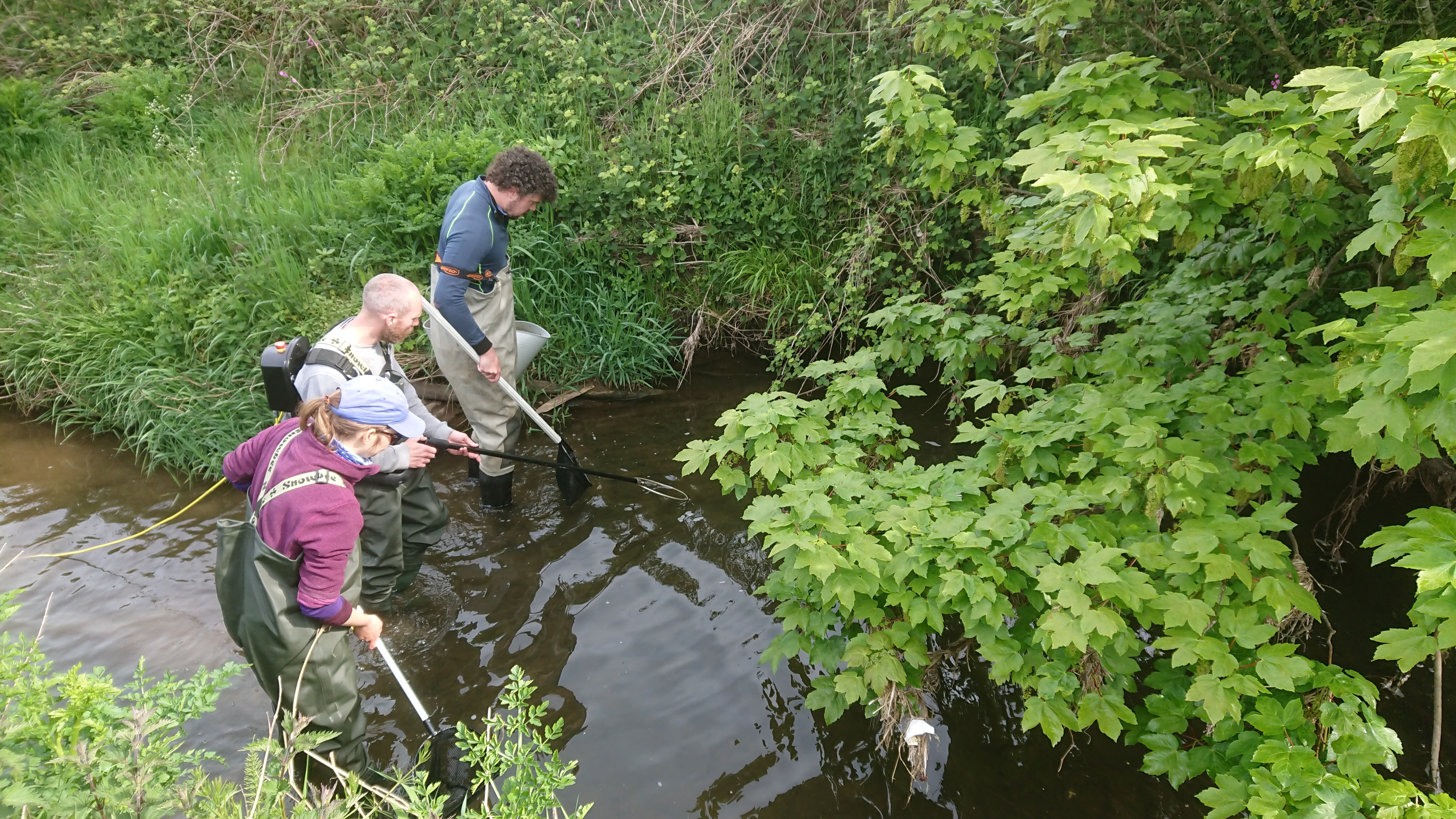
Electrofishing team from Lancaster Environment Centre & Wyre Rivers Trust on Woodplumpton Brook, downstream of the culvert
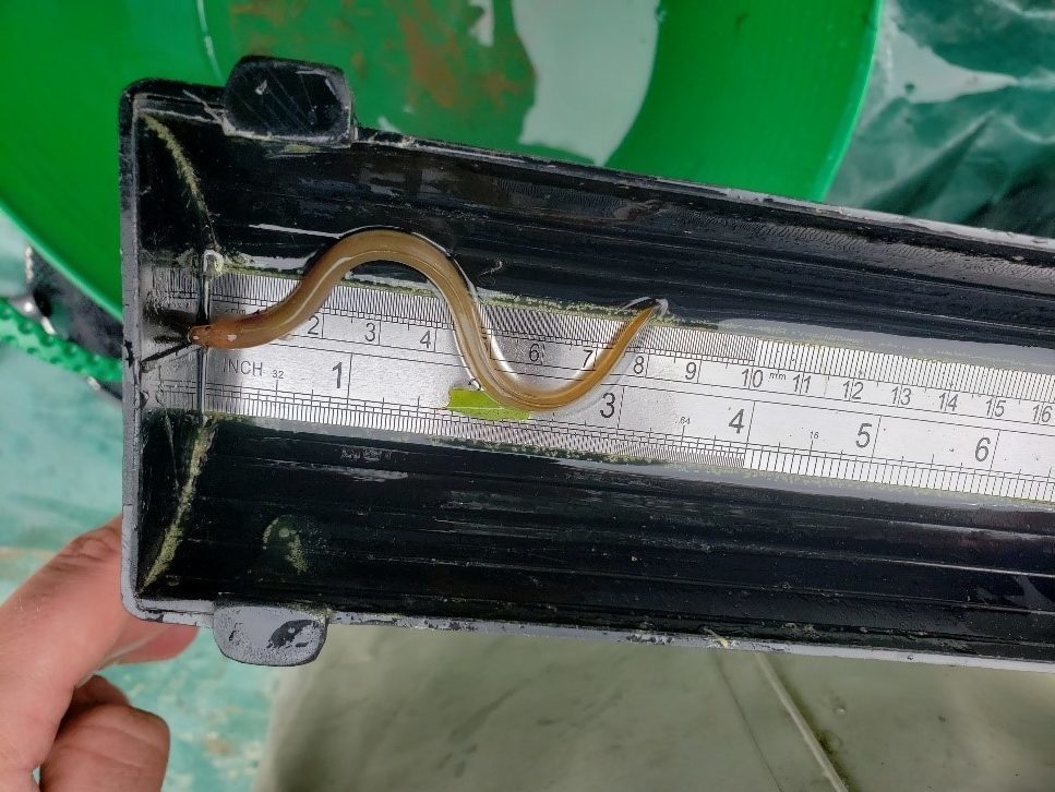
The trials and tribulations of eel measuring…!
The first three years of sampling (2016, 2017, and 2018) occurred in the winter (and will continue in Dec 2019…), but the latest sampling effort (2019) was conducted in the spring. Fish communities may be different in the spring and winter. For example, the brook may be used only as a spawning habitat or nursery by coarse fish during the summer or as a refuge from spate flows on the Wyre during winter so spring data were an interesting addition to the previous three years. We also noticed that 2017 fish populations were very low, likely because of a severe pollution event occurring somewhere upstream. Luckily, since we had three additional years of data, we were able to remove 2017 numbers from our dataset to get a clearer picture of what has happened in the stream in response to restoration.
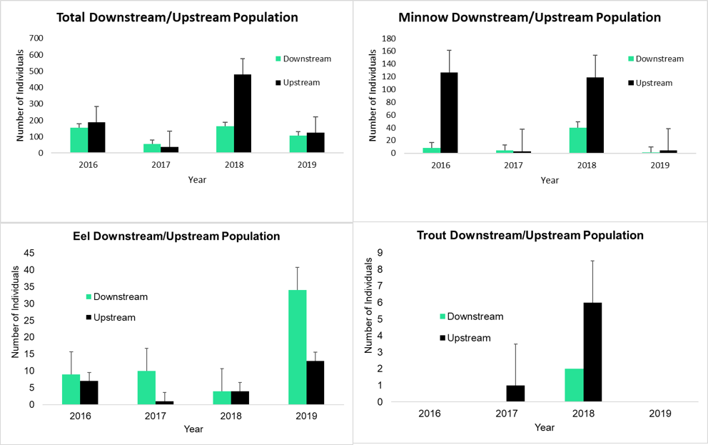
Fish populations upstream and downstream of the culvert over the four years of the study. Error bars are standard deviation. Note the very low populations in 2017, and the increase in trout populations during winter 2017 and 2018.
When analysing the data, we discovered that fish biodiversity (Simpson’s reciprocal index of biodiversity) upstream and downstream of the culvert was significantly higher the years after restoration (2018 and 19) than it was before restoration (2016). That’s a win for fish in Woodplumpton Brook!
We also found that fish lengths were more similar upstream and downstream after culvert restoration. This pattern suggests that, instead of only little fish getting through the shallow water of the culvert, the added baffles have increased depth enough for bigger fish to pass through as well. In other words, the bigger fish finally crossed the road.
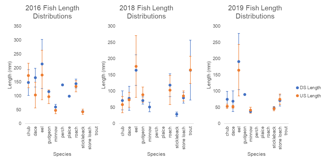
Fish length distributions from 2016 (pre restoration) and 2018/ 2019 (post restoration). Error bars are standard deviations. Fish lengths upstream and downstream become more similar over the years, indicating that fish are better able to get through the culvert!
Unfortunately, we didn’t catch any trout in Woodplumpton Brook in spring 2019, but we cannot deduce too much from one time point so far. We did see increasing numbers of trout in the winter months of 2017 and 2018. We are excited to sample again in winter 2019 to see if this trend continues.
Since restoration works in 2016, fish communities in Woodplumpton Brook have shown a lot of recovery. Changes in biodiversity and length distribution measured in 2017, one year after restoration works, continued through 2019. This indicates that the improvements in fish community health will probably be long lasting. Continued yearly monitoring in Woodplumpton Brook make it a valuable example of culvert restoration and fish community recovery in Northern England.
Jessie Moravek (@JessieMoravek)
